I love a good backroad! We were headed to the Boudin Festival in Scott, LA and Waze alerted us to a traffic Jam on I-10 just west of Port Allen, LA. Waze rerouted us onto Rosedale Road to bypass the jam. I’ve seen the road on maps, but I’ve never had a reason to travel it.
[iframe src=”https://streamable.com/s/uks50/ybjfnk” width=”100%” height=”500″]
The unique thing about this road is that it has all of the scenes of southern Louisiana all in one. Traveling down this road will allow you to see open prairies and agricultural land, swampland, small town Louisiana, and bayou scenery.
The Road
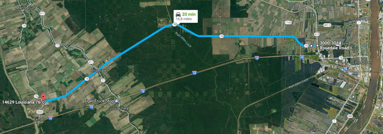
Total Length: 16.8 Miles
Travel Time: 20 Minutes
My trip started when Waze directed me to LA 415 in Port Allen. Rosedale Road is about one mile from I-10. Once you turn on Rosedale Road, you see the Port Allen Soccer Complex and Port Allen High School. If you’ve ever been to Kite Fest Louisiane’ you’ll recognize the area.
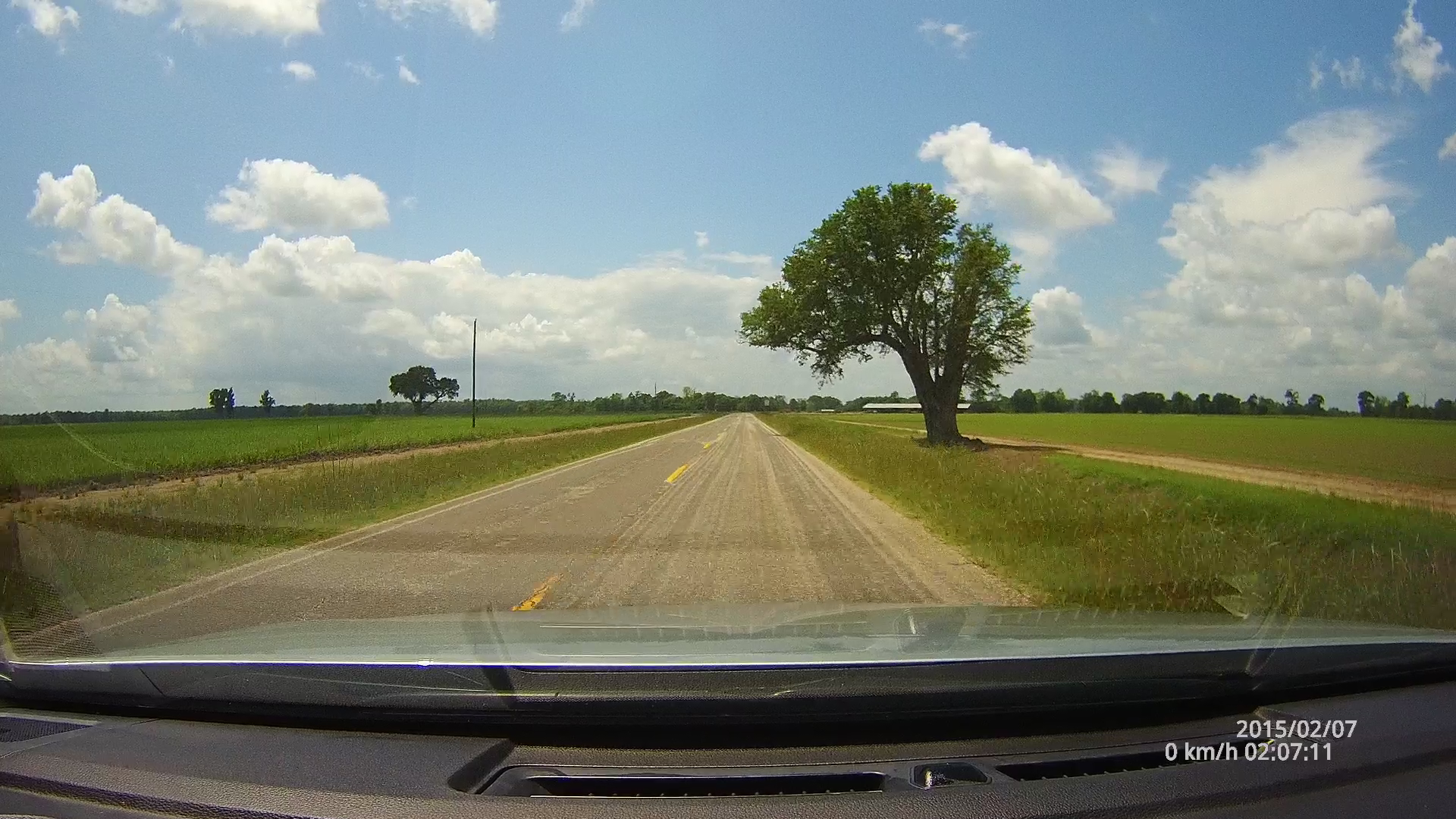
From there, you’ll travel pas the Carruth Scout Preserve, a local Boy Scout destination that owned by the Istrouma Area Council. You’ll then see a mix of wooded areas and a few neighborhoods. The road then wanders into wide open lands where you’ll see a mix of prairies and agricultural fields. It’s kind of refreshing to see such an open sky as you see in the video at the top of this post. Usually your view in southern Louisiana is crowded with trees or other vegetation.
[iframe src=”https://www.google.com/maps/embed?pb=!1m0!3m2!1sen!2sus!4v1492970625697!6m8!1m7!1stRwSF0p5dmNIcF0tNd9BBA!2m2!1d30.46823933975351!2d-91.29752371306533!3f268.4596576072091!4f-1.1283301205760807!5f1.1924812503605784″ width=”800″ height=”400″ frameborder=”0″ allowfullscreen=”allowfullscreen” width=”100%” height=”400″]
From the wide open lands, you then immediately pass through a swamp. It’s as if they had to truck in loads of dirt to build this road back in the day. The road itself seems to form a small levee as it cuts through this swamp on its way to Rosedale. Water is immediately off to both sides of the road, so don’t mess up. Keep the wheel straight!
[iframe src=”https://www.google.com/maps/embed?pb=!1m0!3m2!1sen!2sus!4v1492971675509!6m8!1m7!1s86-iDsRc-MC-6wu947DDjg!2m2!1d30.46079227798814!2d-91.41968125401571!3f233.18800724085884!4f-9.493436033848283!5f0.7820865974627469″ width=”100%” height=”400″]
The Village of Rosedale
After the swamp, you’ll cross over into Iberville Parish. Rosedale is a pretty small Louisiana town. It is, however, big enough to have its own Wikipedia page! The setting of this town is your average super small Louisiana town. You’ll see the local grocer, gas station, church and residential homes. There is usually a main intersection which in Rosedale features a blinking stop and caution light depending on which side of the road you approach. This town feels like time froze starting around the late 60s. It’s definitely interesting to see.
Wikipedia says there are 753 people in Rosedale as of the year 2000. Looking at the historical numbers, it seems this village has grown in size about 5.3% since 1960.
After Rosedale, the road gets noticeably rougher but it’s still ok to travel. You’ll pass through some more open fields until the road ends at LA 3000 on the edge of the Atchafalaya Swamp. There was this one interesting tree on the side of the road in a wide open field which you can see in the video at the top of this post. Once you reach LA 3000, you can take a left to head back towards I-10 to points beyond.
If you’re out on a Sunday drive, this is one to take if you’re around the Baton Rouge area.
Leave a Reply